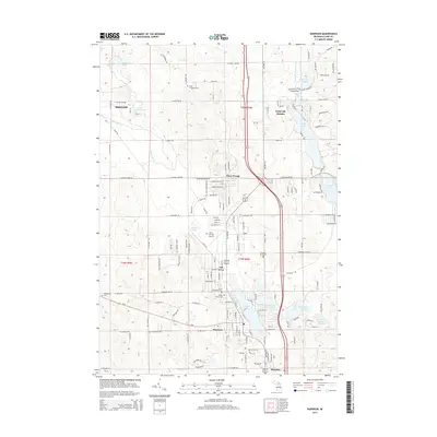
2014 Map of Harrison
USGS Topo · Published 2014About this map
Harrison serves as the hub of this Michigan landscape, situated around the shores of Budd Lake and surrounded by a network of smaller glacial lakes and residential enclaves. The settlement pattern is defined by clusters of seasonal and year-round communities such as Long Lake Heights, Piney Woods, and Ash Acres, reflecting the region's development as a central recreational and residential corridor. Local genealogy is well-documented through several established burial grounds, including Maple Grove Cem, Pleasant Plains Cem, and Saint Athanasius Cem. Transportation and infrastructure are anchored by the Clare County Airport and the north-south transit corridor. To the north, the small settlement of Frost and the Frost Township Cem mark the transition into more wooded terrain, while numerous water bodies like Sutherland Lake and Arnold Lake punctuate the township sections.
Find a feature on this map
187 named features on this map. Tap any name to fly to it.
Don’t see what you’re looking for? This feature index may not catch every label — zoom into the map to look around manually.
Map Details
Editions of this 2014 Harrison Map
This is the sole edition of this map. No revisions or reprints were ever made.
Other maps of this area

1954 · Traverse City
USGS Topo · 1:250,000

1954 · Midland
USGS Topo · 1:250,000

1957 · Harrison
USGS Topo · 1:62,500

1958 · Traverse City
USGS Topo · 1:250,000

1958 · Midland
USGS Topo · 1:250,000

1959 · Midland
USGS Topo · 1:250,000

1959 · Clare
USGS Topo · 1:62,500

1966 · Midland
USGS Topo · 1:250,000

1969 · Meredith NW
USGS Topo · 1:24,000

1969 · Meredith SW
USGS Topo · 1:24,000