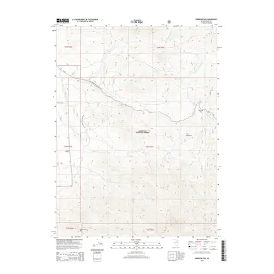
2014 Map of Harrison Pass
USGS Topo · Published 2014About this map
Harrison Pass serves as a critical topographic notch through the high elevations of the Ruby Mountains, providing a primary passage through this portion of the Humboldt National Forest. The landscape is defined by a radial drainage pattern where numerous creeks, including Toyn Cr, Pearl Cr, and Green Mountain Cr, descend from the steep ridgelines. The transition from high peaks like Rattlesnake Mtn to the canyon floors below is marked by a network of forest roads such as Natl Forest Develop Road 113 Rd and CR-718. This survey provides a clear view of the high-altitude hydrology and the specific corridors used to navigate this part of Elko County, tracing the paths of Indian Cr and Brown Cr as they move toward the valley floors.
Find a feature on this map
25 named features on this map. Tap any name to fly to it.
Don’t see what you’re looking for? This feature index may not catch every label — zoom into the map to look around manually.
Map Details
Editions of this 2014 Harrison Pass Map
This is the sole edition of this map. No revisions or reprints were ever made.
Other maps of this area

1934 · Jiggs
USGS Topo · 1:125,000

1937 · Jiggs
USGS Topo · 1:125,000

1955 · Elko
USGS Topo · 1:250,000

1958 · Elko
USGS Topo · 1:250,000

1959 · Jiggs
USGS Topo · 1:62,500

1959 · Sherman Mtn
USGS Topo · 1:62,500

1962 · Elko
USGS Topo · 1:250,000

1965 · Elko
USGS Topo · 1:250,000

1968 · Franklin Lake SW
USGS Topo · 1:24,000
1968 · Ruby Lake NW
USGS Topo · 1:24,000