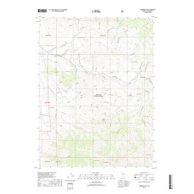
2018 Map of Harrison Pass
USGS Topo · Published 2018About this map
Humboldt National Forest encompasses much of this high-elevation landscape in Elko County, where the southern portion of the Ruby Mountains transitions toward the Carville Basin. The map documents a rugged network of water sources and seasonal drainages, including Pearl Creek, Brown Creek, and the many forks of Corral Creek. For the local historian, the presence of established ranching sites like Corta Ranch and Zaga Ranch indicates the long-standing agricultural activity that defines this region's economy. High-country travel is centered on Harrison Pass, a critical crossing point served by Harrison Pass Rd. This road provides access to wilderness points like the Ruby Crest South Trailhead, while numerous springs such as Basin Springs and Arizona Spring mark the essential water points used by both livestock and travelers through the high basin and range terrain.
Find a feature on this map
87 named features on this map. Tap any name to fly to it.
Don’t see what you’re looking for? This feature index may not catch every label — zoom into the map to look around manually.
Map Details
Editions of this 2018 Harrison Pass Map
This is the sole edition of this map. No revisions or reprints were ever made.
Other maps of this area

1934 · Jiggs
USGS Topo · 1:125,000

1937 · Jiggs
USGS Topo · 1:125,000

1955 · Elko
USGS Topo · 1:250,000

1958 · Elko
USGS Topo · 1:250,000

1959 · Jiggs
USGS Topo · 1:62,500

1959 · Sherman Mtn
USGS Topo · 1:62,500

1962 · Elko
USGS Topo · 1:250,000

1965 · Elko
USGS Topo · 1:250,000

1968 · Franklin Lake SW
USGS Topo · 1:24,000
1968 · Ruby Lake NW
USGS Topo · 1:24,000