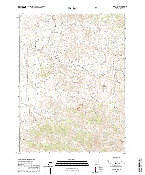
2021 Map of Harrison Pass
USGS Topo · Published 2021About this map
Humboldt National Forest encompasses the high-altitude terrain of the Ruby Mountains in this modern survey of the Elko County backcountry. The landscape is defined by its network of water sources and high peaks, including Green Mtn and Rattlesnake Mtn, which feed various drainages like Green Mountain Cr and Pearl Creek. These peaks served as critical landmarks for early travelers and current ranchers alike, with Zaga Ranch and Corta Ranch Trl indicating the continued agricultural utility of the canyon floors.
Find a feature on this map
89 named features on this map. Tap any name to fly to it.
Don’t see what you’re looking for? This feature index may not catch every label — zoom into the map to look around manually.
Map Details
Editions of this 2021 Harrison Pass Map
This is the sole edition of this map. No revisions or reprints were ever made.
Other maps of this area

1934 · Jiggs
USGS Topo · 1:125,000

1937 · Jiggs
USGS Topo · 1:125,000

1955 · Elko
USGS Topo · 1:250,000

1958 · Elko
USGS Topo · 1:250,000

1959 · Jiggs
USGS Topo · 1:62,500

1959 · Sherman Mtn
USGS Topo · 1:62,500

1962 · Elko
USGS Topo · 1:250,000

1965 · Elko
USGS Topo · 1:250,000

1968 · Franklin Lake SW
USGS Topo · 1:24,000
1968 · Ruby Lake NW
USGS Topo · 1:24,000