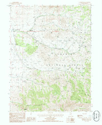
1985 Map of Harrison Pass
USGS Topo · Published 1985About this map
High-altitude water sources and early forest management infrastructure define this 1985 survey of the Ruby Mountains. Central to the map is the Harrison Pass Guard Station, a key waypoint for managing the Humboldt National Forest and the crossing at Harrison Pass. The landscape is dominated by steep terrain and numerous seasonal springs that feed into several named drainages, including Green Creek, Toyn Creek, and South Fork Creek.
Find a feature on this map
29 named features on this map. Tap any name to fly to it.
Don’t see what you’re looking for? This feature index may not catch every label — zoom into the map to look around manually.
Map Details
Editions of this 1985 Harrison Pass Map
This is the sole edition of this map. No revisions or reprints were ever made.
Other maps of this area

1934 · Jiggs
USGS Topo · 1:125,000

1937 · Jiggs
USGS Topo · 1:125,000

1955 · Elko
USGS Topo · 1:250,000

1958 · Elko
USGS Topo · 1:250,000

1959 · Jiggs
USGS Topo · 1:62,500

1959 · Sherman Mtn
USGS Topo · 1:62,500

1962 · Elko
USGS Topo · 1:250,000

1965 · Elko
USGS Topo · 1:250,000

1968 · Franklin Lake SW
USGS Topo · 1:24,000
1968 · Ruby Lake NW
USGS Topo · 1:24,000