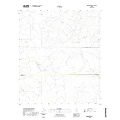
2019 Map of Harrison Ranch
USGS Topo · Published 2019About this map
Harrison Ranch sits at the heart of this Edwards Plateau landscape, where the high-plains terrain is carved by the significant drainage of Bull Hollow and Tenmile Draw. The map records a sparsely populated ranching territory defined by long private roads and the remote Canyon Ranch Airport, which serves as a vital transportation link in this portion of West Texas. The property lines of the early 21st century are bisected by the Sutton Co-Edwards Co boundary line, illustrating how administrative borders cut across the physical geography of the draws. Local transport relies on a network of named routes including Bond Rd and Harrison Rd, providing a clear view of land access and ranching infrastructure as it existed during this period.
Find a feature on this map
15 named features on this map. Tap any name to fly to it.
Don’t see what you’re looking for? This feature index may not catch every label — zoom into the map to look around manually.
Map Details
Editions of this 2019 Harrison Ranch Map
This is the sole edition of this map. No revisions or reprints were ever made.
Other maps of this area

1893 · Rock Springs
USGS Topo · 1:125,000

1954 · Sonora
USGS Topo · 1:250,000

1958 · Sonora
USGS Topo · 1:250,000

1962 · Stewart Ranch
USGS Topo · 1:24,000

1963 · Steen Lake
USGS Topo · 1:24,000

1963 · Harrison Ranch
USGS Topo · 1:24,000

1963 · Live Oak Draw
USGS Topo · 1:24,000

1967 · Dunbar Draw NE
USGS Topo · 1:24,000

1967 · Dunbar Draw SE
USGS Topo · 1:24,000

1970 · Ray Lake NW
USGS Topo · 1:24,000