
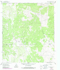
1963 Map of Harrison Ranch
USGS Topo · Published 1965About this map
Harrison Ranch and Brockman Ranch anchor this West Texas landscape, illustrating the remote ranching operations active along the boundary of Sutton and Edwards Counties during the early 1960s. The terrain is defined by the winding paths of Bull Hollow and Tenmile Draw, which cut through the limestone uplands. Industrial activity is visible in the northeastern corner, where the Miers Wilson Gas Field and scattered Gas Wells indicate the expansion of energy production into the Edwards Plateau.
Find a feature on this map
12 named features on this map. Tap any name to fly to it.
Don’t see what you’re looking for? This feature index may not catch every label — zoom into the map to look around manually.
Map Details
Editions of this 1963 Harrison Ranch Map
2 editions found
Other maps of this area

1893 · Rock Springs
USGS Topo · 1:125,000

1954 · Sonora
USGS Topo · 1:250,000

1958 · Sonora
USGS Topo · 1:250,000

1962 · Stewart Ranch
USGS Topo · 1:24,000

1963 · Steen Lake
USGS Topo · 1:24,000

1963 · Live Oak Draw
USGS Topo · 1:24,000

1967 · Dunbar Draw NE
USGS Topo · 1:24,000

1967 · Dunbar Draw SE
USGS Topo · 1:24,000

1970 · Ray Lake NW
USGS Topo · 1:24,000
1971 · Ray Lake
USGS Topo · 1:24,000