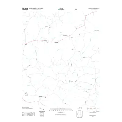
2013 Map of Harrisville
USGS Topo · Published 2013About this map
Harrisville and the surrounding rural communities of Montgomery County are defined by an intricate network of creeks feeding into larger drainages like Big Mountain Cr and Buffalo Cr. This topography of ridges and narrow valleys is punctuated by landmarks such as Luther Mountain and the Harrisville Lookout Tower, which offers a vantage point over the timbered landscape. The settlement pattern follows old road traces like Pekin RD and County Line RD, connecting historic locales such as Capels Mill and Pekin. The map documents a landscape where traditional creek-bottom geography dictates the placement of homes and small crossroads, from Covington in the south to the northern reaches of Cheek Cr. Local family names and community ties are reflected in labels like Pea Ridge and Ex-Way, preserving the spatial identity of this North Carolina region in the early twenty-first century.
Find a feature on this map
73 named features on this map. Tap any name to fly to it.
Don’t see what you’re looking for? This feature index may not catch every label — zoom into the map to look around manually.
Map Details
Editions of this 2013 Harrisville Map
This is the sole edition of this map. No revisions or reprints were ever made.
Other maps of this area

1942 · Troy
USGS Topo · 1:125,000

1949 · Millstone Lake
USGS Topo · 1:24,000

1949 · Jackson Springs
USGS Topo · 1:62,500

1950 · Norman
USGS Topo · 1:24,000

1953 · Raleigh
USGS Topo · 1:250,000

1954 · Raleigh
USGS Topo · 1:250,000

1956 · Mangum
USGS Topo · 1:24,000

1956 · Mount Gilead East
USGS Topo · 1:24,000

1956 · Ellerbe
USGS Topo · 1:24,000

1956 · Harrisville
USGS Topo · 1:24,000