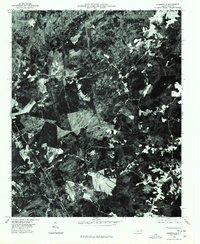
1976 Map of Harrisville
USGS Topo · Published 1978About this map
Harrisville and the southern settlement of Covington anchor this mid-1970s orthophotoquad, which uses rectified aerial imagery to reveal the textured Montgomery County landscape. Unlike a traditional line-drawn map, this photographic record shows the exact footprint of forest clearing, agriculture, and timber management as it existed during the Bicentennial year. Narrow rural roads wind through dense woodland, connecting isolated homesteads and small farm plots that emerge as bright geometric patches against the dark canopy. The imagery, captured by the U.S. Geological Survey in cooperation with the State of North Carolina, provides an unfiltered look at the rural spatial patterns of the Piedmont, highlighting how topography and soil dictated the development of these small communities before more modern development altered the land use.
Find a feature on this map
2 named features on this map. Tap any name to fly to it.
Don’t see what you’re looking for? This feature index may not catch every label — zoom into the map to look around manually.
Map Details
Editions of this 1976 Harrisville Map
This is the sole edition of this map. No revisions or reprints were ever made.
Other maps of this area

1942 · Troy
USGS Topo · 1:125,000

1949 · Millstone Lake
USGS Topo · 1:24,000

1949 · Jackson Springs
USGS Topo · 1:62,500

1950 · Norman
USGS Topo · 1:24,000

1953 · Raleigh
USGS Topo · 1:250,000

1954 · Raleigh
USGS Topo · 1:250,000

1956 · Mangum
USGS Topo · 1:24,000

1956 · Mount Gilead East
USGS Topo · 1:24,000

1956 · Ellerbe
USGS Topo · 1:24,000

1956 · Harrisville
USGS Topo · 1:24,000