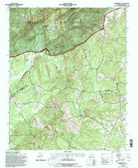
1994 Map of Harrisville
USGS Topo · Published 1996About this map
Uwharrie National Forest dominates the northern reaches of this territory, where the landscape is defined by the prominent heights of Luther Mtn and Harrisville Lookout Mtn. The terrain is deeply etched by a network of waterways including Blue Creek, Cheek Creek, and Beaverdam Creek. This mid-1990s record captures a rural landscape where community life centers on dispersed settlements like Harrisville, Pekin, and Covington.
Find a feature on this map
30 named features on this map. Tap any name to fly to it.
Don’t see what you’re looking for? This feature index may not catch every label — zoom into the map to look around manually.
Map Details
Editions of this 1994 Harrisville Map
This is the sole edition of this map. No revisions or reprints were ever made.
Other maps of this area

1942 · Troy
USGS Topo · 1:125,000

1949 · Millstone Lake
USGS Topo · 1:24,000

1949 · Jackson Springs
USGS Topo · 1:62,500

1950 · Norman
USGS Topo · 1:24,000

1953 · Raleigh
USGS Topo · 1:250,000

1954 · Raleigh
USGS Topo · 1:250,000

1956 · Mangum
USGS Topo · 1:24,000

1956 · Mount Gilead East
USGS Topo · 1:24,000

1956 · Ellerbe
USGS Topo · 1:24,000

1956 · Harrisville
USGS Topo · 1:24,000