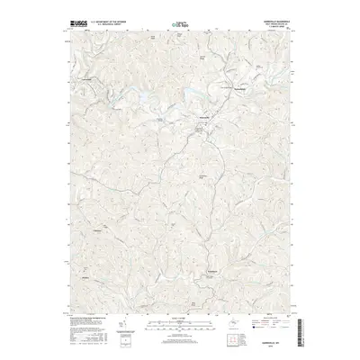
2016 Map of Harrisville
USGS Topo · Published 2016About this map
The North Fork Hughes River meanders through the heart of Ritchie County, shaping a landscape defined by sharp ridges and deep hollows. This area is anchored by Harrisville, where the Independent Order of Odd Fellows Cem and Masonic Cem mark the community's established history. To the west, the N Bend Rail Trail follows the former rail corridor through Cornwallis, while the N Bend State Park preserves the natural bends of the river. The map reveals a dense network of country roads connecting smaller settlements like Washburn and Hannahdale. Numerous family and community landmarks are scattered across the terrain, including Moyers Cem and the Indian Creek Churchyard, offering significant detail for those tracing the lineage of rural West Virginia settlements. The naming of high points such as Victory Ridge and Oil Ridge suggests the historic industrial and cultural influences that have shaped this portion of the Allegheny Plateau.
Find a feature on this map
106 named features on this map. Tap any name to fly to it.
Don’t see what you’re looking for? This feature index may not catch every label — zoom into the map to look around manually.
Map Details
Editions of this 2016 Harrisville Map
This is the sole edition of this map. No revisions or reprints were ever made.
Other maps of this area

1905 · West Union
USGS Topo · 1:62,500

1906 · Saint Marys
USGS Topo · 1:62,500

1906 · Holbrook
USGS Topo · 1:62,500

1907 · Harrisville
USGS Topo · 1:62,500

1924 · St Marys
USGS Topo · 1:62,500

1924 · Harrisville
USGS Topo · 1:62,500

1924 · West Union
USGS Topo · 1:62,500

1924 · Holbrook
USGS Topo · 1:62,500

1926 · Harrisville
USGS Topo · 1:62,500

1926 · Holbrook
USGS Topo · 1:62,500