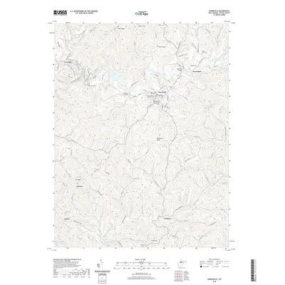
2019 Map of Harrisville
USGS Topo · Published 2019About this map
Harrisville serves as the focal point of this region, anchored by the Ritchie County Courthouse and Ritchie County Magistrate Court. The town's grid is bounded by W High St and S Spring St, while the Independent Order of Odd Fellows Cemetery sits on its southern edge. This hub of local governance is surrounded by a network of rural settlements including Hannahdale, Cornwallis, and Washburn, many of which developed along the winding corridors of the North Fork Hughes River.
Find a feature on this map
109 named features on this map. Tap any name to fly to it.
Don’t see what you’re looking for? This feature index may not catch every label — zoom into the map to look around manually.
Map Details
Editions of this 2019 Harrisville Map
This is the sole edition of this map. No revisions or reprints were ever made.
Other maps of this area

1905 · West Union
USGS Topo · 1:62,500

1906 · Saint Marys
USGS Topo · 1:62,500

1906 · Holbrook
USGS Topo · 1:62,500

1907 · Harrisville
USGS Topo · 1:62,500

1924 · St Marys
USGS Topo · 1:62,500

1924 · Harrisville
USGS Topo · 1:62,500

1924 · West Union
USGS Topo · 1:62,500

1924 · Holbrook
USGS Topo · 1:62,500

1926 · Harrisville
USGS Topo · 1:62,500

1926 · Holbrook
USGS Topo · 1:62,500