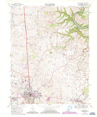
1967 Map of Harrodsburg
USGS Topo · Published 1987About this map
The historic county seat of Harrodsburg serves as the focal point for this survey, showcasing a landscape transitioning through the mid-20th century. The town's layout is intricately detailed, featuring the Spring Hill Cem, the County Fairgrounds, and the Harrodsburg-Mercer Co Airport. Outside the urban center, the map documents a network of rural settlements like McAfee, Braxton, and Stringtown, many connected by family-named thoroughfares such as Bonta Lane and Chinn Lane. The Southern RR cuts through the territory, supporting local commerce at spots like Judd Siding.
Find a feature on this map
55 named features on this map. Tap any name to fly to it.
Don’t see what you’re looking for? This feature index may not catch every label — zoom into the map to look around manually.
Map Details
Editions of this 1967 Harrodsburg Map
3 editions found
Other maps of this area

1905 · Harrodsburg
USGS Topo · 1:125,000

1950 · Bryantsville
USGS Topo · 1:24,000

1952 · Perryville
USGS Topo · 1:24,000

1952 · Keene
USGS Topo · 1:24,000

1952 · Danville
USGS Topo · 1:24,000

1952 · Harrodsburg
USGS Topo · 1:24,000

1952 · Cornishville
USGS Topo · 1:24,000

1952 · Bryantsville
USGS Topo · 1:24,000

1952 · Salvisa
USGS Topo · 1:24,000

1952 · Mc Brayer
USGS Topo · 1:24,000