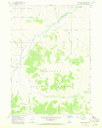
1967 Map of Harry Canyon
USGS Topo · Published 1971About this map
The White Knob Mts dominate this mid-1960s landscape, where drainage patterns define the geography of the Challis National Forest. The Big Lost River winds through the northern portion of the quadrangle, joined by numerous tributaries including Burnt Creek and Garden Creek. Human activity is concentrated along the river valley and forest access routes, indicated by the Wildhorse Guard Station and a nearby Radio Facility. A remote Landing Strip Road and various jeep trails underscore the area's importance for forest management and backcountry access during this era. Topographic details reveal a complex network of canyons such as Harry Canyon and Wildcat Canyon, illustrating the high-elevation terrain before modern developments. The presence of a Gaging Station on the river suggests a reliance on monitoring water resources in this part of Custer County.
Find a feature on this map
30 named features on this map. Tap any name to fly to it.
Don’t see what you’re looking for? This feature index may not catch every label — zoom into the map to look around manually.
Map Details
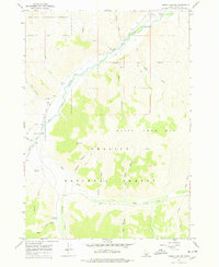
Editions of this 1967 Harry Canyon Map
2 editions found
Other maps of this area

1895 · Hailey
USGS Topo · 1:125,000

1897 · Hailey
USGS Topo · 1:125,000

1929 · Bayhorse
USGS Topo · 1:125,000

1935 · MacKay
USGS Topo · 1:96,000

1935 · Borah Peak
USGS Topo · 1:125,000

1938 · Borah Peak
USGS Topo · 1:125,000

1955 · Dubois
USGS Topo · 1:250,000

1955 · Idaho Falls
USGS Topo · 1:250,000

1955 · Hailey
USGS Topo · 1:250,000

1957 · Challis
USGS Topo · 1:250,000