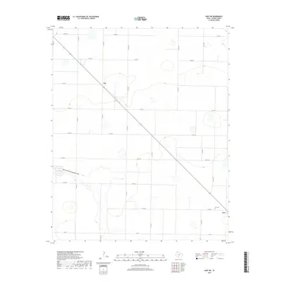
2019 Map of Hart NW
USGS Topo · Published 2019About this map
Roy and the northern outskirts of Hart define the landscape of this Castro County agricultural region. The terrain is characterized by a grid-like network of county roads, such as Co RD 619 and Co RD 519, which facilitate movement across the High Plains. The drainage of North Fork Running Water Draw meanders through the southwestern portion of the sheet, providing a natural contrast to the strictly partitioned farmland. For those researching local family history, the presence of Hart Cem near the town of Hart provides a specific point of interest. The map illustrates the dominance of rural infrastructure in West Texas, where long, straight thoroughfares like Fm 145 and the diagonal route of Highway 194 connect small communities and isolated homesteads within a vast expanse of cultivated land.
Find a feature on this map
22 named features on this map. Tap any name to fly to it.
Don’t see what you’re looking for? This feature index may not catch every label — zoom into the map to look around manually.
Map Details
Editions of this 2019 Hart NW Map
This is the sole edition of this map. No revisions or reprints were ever made.
Other maps of this area

1954 · Clovis
USGS Topo · 1:250,000

1958 · Clovis
USGS Topo · 1:250,000

1962 · Dodd NE
USGS Topo · 1:24,000

1963 · Hart NW
USGS Topo · 1:24,000

1963 · Dodd SE
USGS Topo · 1:24,000

1963 · Hart SW
USGS Topo · 1:24,000

1965 · Dimmitt
USGS Topo · 1:24,000

1965 · Hart
USGS Topo · 1:24,000

1965 · Nazareth SW
USGS Topo · 1:24,000

1965 · Hilburn
USGS Topo · 1:24,000