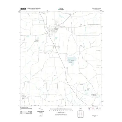
2011 Map of Hartford
USGS Topo · Published 2011About this map
The town of Hartford serves as a central hub for this portion of Geneva County, characterized by a dense network of county roads and agricultural land. A series of private water management structures defines the southern landscape, including the Paul Kennedy Number 5 Dam and its counterparts along Tennille Creek. The rural character is further marked by numerous family and community burial grounds such as Shiloh Cemetery and Adoniram Cemetery, providing significant points of interest for genealogical research. To the southwest, the small settlement of Black sits near the Florida border, anchored by the Black Post Office and Black Cemetery. Local topography is shaped by several tributaries, notably Justice Mill Creek and Hurricane Creek, which drain toward the larger systems south of the Alabama line. The presence of the Pondtown Lookout Tower near Pondtown Cemetery highlights the region's historical commitment to forest observation and fire safety.
Find a feature on this map
94 named features on this map. Tap any name to fly to it.
Don’t see what you’re looking for? This feature index may not catch every label — zoom into the map to look around manually.
Map Details
Editions of this 2011 Hartford Map
This is the sole edition of this map. No revisions or reprints were ever made.
Other maps of this area

1942 · Enterprise
USGS Topo · 1:125,000

1950 · Izagora
USGS Topo · 1:24,000

1950 · Esto
USGS Topo · 1:24,000

1951 · Graceville
USGS Topo · 1:24,000

1951 · Esto
USGS Topo · 1:24,000

1953 · Dothan
USGS Topo · 1:250,000

1954 · Dothan
USGS Topo · 1:250,000

1954 · Tallahassee
USGS Topo · 1:250,000

1955 · Dothan
USGS Topo · 1:250,000

1957 · Malvern
USGS Topo · 1:24,000