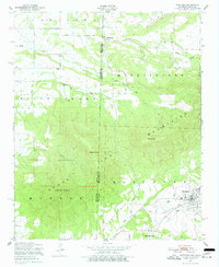
1947 Map of Hartford
USGS Topo · Published 1977About this map
Sugar Loaf Mountain and the high ridges of Kully Chaha dominate this landscape along the border of Arkansas and Oklahoma. Recorded shortly after the war, the map depicts a region defined by its topography and the extractive economy of the Arkoma Basin. The town of Hartford serves as a local hub, where a network of roads and rails supports nearby operations, including a marked Coal mine along Coal Creek. Smaller settlements like Slaytonville and West Hartford are connected by winding routes that navigate the terrain between Midland Peak and Oklahoma Peak. Numerous watercourses such as Riddle Creek, Gap Creek, and Sugar Loaf Creek drain the valleys, while several scattered Cemeteries provide valuable markers for genealogical research in this borderland area of Sebastian and Le Flore counties.
Find a feature on this map
25 named features on this map. Tap any name to fly to it.
Don’t see what you’re looking for? This feature index may not catch every label — zoom into the map to look around manually.
Map Details
Editions of this 1947 Hartford Map
3 editions found
Other maps of this area

1887 · Poteau Mountain #2
USGS Topo · 1:62,500

1887 · Greenwood
USGS Topo · 1:62,500

1890 · Fort Smith
USGS Topo · 1:125,000

1890 · Poteau Mountain
USGS Topo · 1:125,000

1899 · Poteau Mountain
USGS Topo · 1:125,000

1900 · Sallisaw
USGS Topo · 1:125,000

1900 · Winding Stair
USGS Topo · 1:125,000

1909 · Winding Stair
USGS Topo · 1:125,000

1911 · Sallisaw
USGS Topo · 1:125,000

1943 · Fort Smith
USGS Topo · 1:125,000