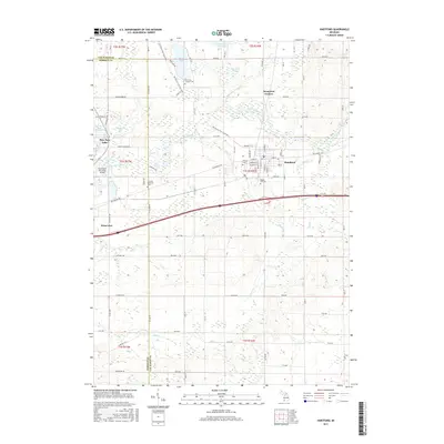
2017 Map of Hartford
USGS Topo · Published 2017About this map
Hartford and the surrounding Van Buren County landscape are defined by a complex network of glacial lakes and river systems. The town center is densely plotted around W Main St and E Main St, situated just north of the winding Paw Paw River. This 2017 survey reveals a region balanced between small-town infrastructure and preserved recreation, most notably along the Van Buren Trail State Park which cuts diagonally across the terrain. To the west, the eastern edge of Watervliet and the sprawling Paw Paw Lake provide a clear view of the area's developed shoreline. Several burial grounds, including the Rush Lake Catholic Cem and Maple Hill Cem, offer points of interest for genealogists tracing local family histories. The presence of the Watervliet Municipal Airport and the interstate corridor highlights the modern transportation links that connect these historic lakeside communities.
Find a feature on this map
55 named features on this map. Tap any name to fly to it.
Don’t see what you’re looking for? This feature index may not catch every label — zoom into the map to look around manually.
Map Details
Editions of this 2017 Hartford Map
This is the sole edition of this map. No revisions or reprints were ever made.
Other maps of this area

1927 · Hartford
USGS Topo · 1:62,500

1927 · Bangor
USGS Topo · 1:62,500

1927 · Benton Harbor
USGS Topo · 1:62,500

1927 · South Haven
USGS Topo · 1:62,500

1930 · South Haven
USGS Topo · 1:62,500

1930 · Benton Harbor
USGS Topo · 1:62,500

1931 · Bangor
USGS Topo · 1:62,500

1931 · Hartford
USGS Topo · 1:62,500

1943 · South Haven
USGS Topo · 1:62,500

1943 · Bangor
USGS Topo · 1:62,500