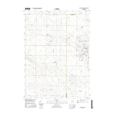
2015 Map of Hartford West
USGS Topo · Published 2015About this map
The Rubicon River and its various tributaries, including Butler Cr and Woodland Cr, define the drainage and early settlement patterns of this section of the Wisconsin landscape. The western outskirts of Hartford are prominently featured, showing the city's growth toward the Dodge and Washington county line. The presence of Hartford Municipal Airport and Innovation Way indicates the modern industrial and transportation infrastructure that has integrated into the older agricultural grid. Local history is anchored by several long-standing community landmarks, from the Neosho Millpond in the southwest to a cluster of historic burial grounds such as Union Cem and Saint Killian Cem. The map provides a detailed view of the transition from urban streets to the hamlets of Rubicon and Saylesville, surrounded by glacial features like Druid Lake and Collins Lake.
Find a feature on this map
96 named features on this map. Tap any name to fly to it.
Don’t see what you’re looking for? This feature index may not catch every label — zoom into the map to look around manually.
Map Details
Editions of this 2015 Hartford West Map
This is the sole edition of this map. No revisions or reprints were ever made.
Other maps of this area

1892 · Watertown
USGS Topo · 1:62,500

1892 · Oconomowoc
USGS Topo · 1:62,500

1894 · Watertown
USGS Topo · 1:62,500

1904 · Hartford
USGS Topo · 1:62,500

1909 · Oconomowoc
USGS Topo · 1:62,500

1955 · Horicon
USGS Topo · 1:62,500

1957 · Madison
USGS Topo · 1:250,000

1959 · Ixonia
USGS Topo · 1:24,000
1959 · Stonebank
USGS Topo · 1:24,000

1959 · Hartford
USGS Topo · 1:62,500