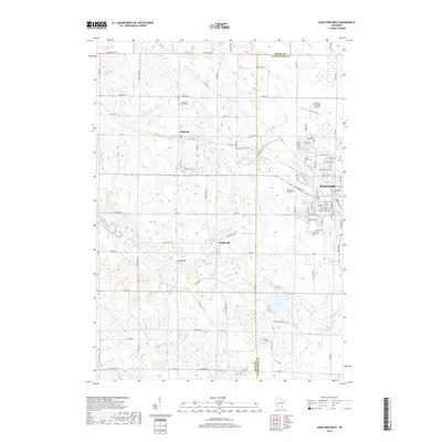
2018 Map of Hartford West
USGS Topo · Published 2018About this map
Hartford anchors the eastern edge of this glacial landscape, where the Rubicon River winds through rolling terrain toward the smaller settlements of Rubicon and Saylesville. The area reflects a deep-rooted agricultural and rural character, punctuated by historic burial grounds like the Hallowell Farm Cem and Saint Kilian Cem. The survey details a complex hydrological system, including Druid Lake and Collins Lake in the south, alongside the headwaters of the Ashippun River. Transport patterns are defined by a dense grid of county roads and distinctive landmarks such as Bridge 900. The map captures the suburban expansion of Hartford near the Hartford Municipal Airport, while preserving the locations of long-standing community centers like Union Cem and Pleasant Hill Cem, providing a clear picture of Dodge and Washington County land use.
Find a feature on this map
99 named features on this map. Tap any name to fly to it.
Don’t see what you’re looking for? This feature index may not catch every label — zoom into the map to look around manually.
Map Details
Editions of this 2018 Hartford West Map
This is the sole edition of this map. No revisions or reprints were ever made.
Other maps of this area

1892 · Watertown
USGS Topo · 1:62,500

1892 · Oconomowoc
USGS Topo · 1:62,500

1894 · Watertown
USGS Topo · 1:62,500

1904 · Hartford
USGS Topo · 1:62,500

1909 · Oconomowoc
USGS Topo · 1:62,500

1955 · Horicon
USGS Topo · 1:62,500

1957 · Madison
USGS Topo · 1:250,000

1959 · Ixonia
USGS Topo · 1:24,000
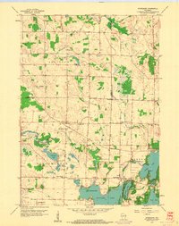
1959 · Stonebank
USGS Topo · 1:24,000

1959 · Hartford
USGS Topo · 1:62,500