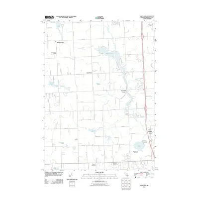
2011 Map of Hartland
USGS Topo · Published 2011About this map
North Ore Creek and Cranberry Creek meander through this portion of Livingston County, shaping a landscape defined by glacial lakes and small rural settlements. The unincorporated community of Parshallville sits along the creek in the center of the map, while the village of Hartland is situated to the southeast, anchored by the Hartland Post Office. This 2011 survey documents a dense concentration of local history markers, including the Deerfield Center Cemetery, Riddle Cemetery, and Smith Cemetery.
Find a feature on this map
60 named features on this map. Tap any name to fly to it.
Don’t see what you’re looking for? This feature index may not catch every label — zoom into the map to look around manually.
Map Details
Editions of this 2011 Hartland Map
This is the sole edition of this map. No revisions or reprints were ever made.
Other maps of this area

1907 · Howell
USGS Topo · 1:62,500

1909 · Howell
USGS Topo · 1:62,500

1909 · Milford
USGS Topo · 1:62,500

1920 · Holly
USGS Topo · 1:62,500

1922 · Holly
USGS Topo · 1:62,500

1922 · Durand
USGS Topo · 1:62,500

1943 · Holly
USGS Topo · 1:62,500

1943 · Durand
USGS Topo · 1:62,500

1954 · Detroit
USGS Topo · 1:250,000

1961 · Detroit
USGS Topo · 1:250,000
Featured Places
- Hartland Township, MI
- Oceola Township, MI
- Tyrone Township, MI
- Deerfield Township, MI
- Hartland, Hartland Township