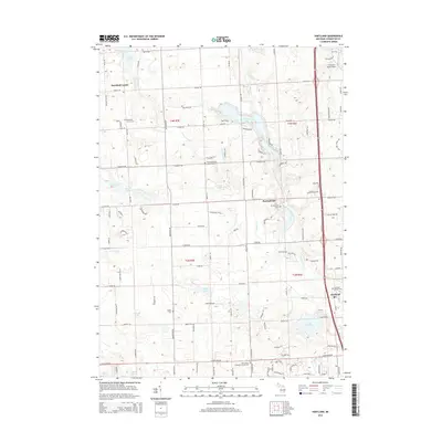
2014 Map of Hartland
USGS Topo · Published 2014About this map
Parshallville and Deerfield Center anchor the rural landscape of Livingston County in this 2014 survey. The area is defined by a dense network of glacial water bodies, including the centrally located Shannon Lake and Payne Lake, along with the winding course of North Ore Creek. For those researching local families, the map is particularly rich in cemetery locations, from the Saint Augustine's Catholic Cem near the center to the Hartland Village Cem in the southeast. Transportation is dominated by the modern US-23 corridor, which skirts the eastern edge near Hartland. Small aviation history is preserved at Trollman's Field Airport in the northeast corner. This modern survey provides a detailed look at the interface between historic rural settlements and the suburban development patterns spreading through the township's lake-dotted geography.
Find a feature on this map
110 named features on this map. Tap any name to fly to it.
Don’t see what you’re looking for? This feature index may not catch every label — zoom into the map to look around manually.
Map Details
Editions of this 2014 Hartland Map
This is the sole edition of this map. No revisions or reprints were ever made.
Other maps of this area

1907 · Howell
USGS Topo · 1:62,500

1909 · Howell
USGS Topo · 1:62,500

1909 · Milford
USGS Topo · 1:62,500

1920 · Holly
USGS Topo · 1:62,500

1922 · Holly
USGS Topo · 1:62,500

1922 · Durand
USGS Topo · 1:62,500

1943 · Holly
USGS Topo · 1:62,500

1943 · Durand
USGS Topo · 1:62,500

1954 · Detroit
USGS Topo · 1:250,000

1961 · Detroit
USGS Topo · 1:250,000
Featured Places
- Hartland Township, MI
- Oceola Township, MI
- Tyrone Township, MI
- Deerfield Township, MI
- Hartland, Hartland Township