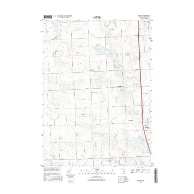
2017 Map of Hartland
USGS Topo · Published 2017About this map
Parshallville and Deerfield Center anchor this landscape in Livingston County, where a dense network of country roads connects family-named landmarks and local burial grounds. The geography is defined by a concentration of glacial lakes and small water bodies, including Lake Walden, Shannon Lake, and Neff Lake, many of which are fed by the meandering Cranberry Cr. Genealogists will find a high density of documented cemeteries across the townships, from the Deerfield Center Cem in the north to the Hartland Village Cem near the eastern margin.
Find a feature on this map
128 named features on this map. Tap any name to fly to it.
Don’t see what you’re looking for? This feature index may not catch every label — zoom into the map to look around manually.
Map Details
Editions of this 2017 Hartland Map
This is the sole edition of this map. No revisions or reprints were ever made.
Other maps of this area

1907 · Howell
USGS Topo · 1:62,500

1909 · Howell
USGS Topo · 1:62,500

1909 · Milford
USGS Topo · 1:62,500

1920 · Holly
USGS Topo · 1:62,500

1922 · Holly
USGS Topo · 1:62,500

1922 · Durand
USGS Topo · 1:62,500

1943 · Holly
USGS Topo · 1:62,500

1943 · Durand
USGS Topo · 1:62,500

1954 · Detroit
USGS Topo · 1:250,000

1961 · Detroit
USGS Topo · 1:250,000
Featured Places
- Hartland Township, MI
- Oceola Township, MI
- Tyrone Township, MI
- Deerfield Township, MI
- Hartland, Hartland Township