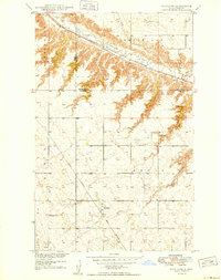
1949 Map of Hartland
USGS Topo · Published 1949About this map
Hartland sits at the junction of two major rail corridors in this late 1940s survey of Ward and Renville counties. The Minneapolis St Paul and Sault Ste Marie line tracks the winding course of the Des Lacs River through the northern portion of the sheet, while the Great Northern railroad cuts a diagonal path toward the town center. This landscape is defined by the sharp contrast between the level prairie and the deeply incised river valley and coulees, such as Feldner Coulee and Flaten Coulee. Local genealogy is well-supported by the inclusion of community landmarks like Viola School No 1, St Anthony Cem, Johnson Cem, and Zion Cem. These sites, along with the township divisions of Carbondale, White Ash, and Carpio, provide a clear view of the rural social structure and transportation network before significant late-century changes.
Find a feature on this map
15 named features on this map. Tap any name to fly to it.
Don’t see what you’re looking for? This feature index may not catch every label — zoom into the map to look around manually.
Map Details
Editions of this 1949 Hartland Map
2 editions found
Other maps of this area

1947 · Tolley
USGS Topo · 1:62,500

1948 · Donnybrook
USGS Topo · 1:24,000

1949 · Tolley SE
USGS Topo · 1:24,000

1949 · Hartland
USGS Topo · 1:24,000

1949 · Carpio
USGS Topo · 1:24,000

1949 · Grano SW
USGS Topo · 1:24,000

1950 · Tolley
USGS Topo · 1:62,500
1951 · Grano
USGS Topo · 1:62,500

1954 · Minot
USGS Topo · 1:250,000

1958 · Minot
USGS Topo · 1:250,000