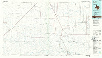
1985 Map of Hartley
USGS Topo · Published 1986About this map
The Canadian River cuts through the southern reaches of this Panhandle landscape, where the town of Tascosa and the Boys Ranch occupy the breaks near the water. This 1980s compilation reveals a region defined by extensive ranching and energy extraction, with a large Oil And Gas Field situated north of Middlewell. The infrastructure of the high plains is anchored by the Burlington Northern and St. Louis Southwestern railroads, which connect isolated shipping points like Rehm, King, and Middle Water.
Find a feature on this map
62 named features on this map. Tap any name to fly to it.
Don’t see what you’re looking for? This feature index may not catch every label — zoom into the map to look around manually.
Map Details
Editions of this 1985 Hartley Map
2 editions found
Other maps of this area

1934 · Ady
USGS Topo · 1:62,500

1934 · Cliffside
USGS Topo · 1:62,500

1936 · Fourways
USGS Topo · 1:62,500

1936 · Cliffside
USGS Topo · 1:62,500

1936 · Ady
USGS Topo · 1:62,500

1953 · Marsh
USGS Topo · 1:24,000

1953 · Puente
USGS Topo · 1:24,000

1953 · Masterson
USGS Topo · 1:24,000

1954 · Tucumcari
USGS Topo · 1:250,000

1954 · Perryton
USGS Topo · 1:250,000