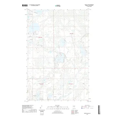
2019 Map of Hartley Lake
USGS Topo · Published 2019About this map
Hartley Lake and the winding course of the W Fork Prairie River define this heavily glaciated pocket of the northern Minnesota woods. The landscape is a dense network of water bodies, from the larger White Swan Lake and Round Lake in the northwest to the more isolated Jack Lake and Rahkos Lake further south. The Wolf RR 2 line cuts through the northeastern corner near Wolf Lake, while the Scenic Hwy and a network of county roads like Co Hwy 52 provide access to the various lakefronts and scattered residences. The presence of family-named routes such as Rahko Rd and Murden Rd suggests a history of local landholding and seasonal recreation centered around the region's diverse aquatic features, including Christmas Lake and the secluded Stumple Lake.
Find a feature on this map
55 named features on this map. Tap any name to fly to it.
Don’t see what you’re looking for? This feature index may not catch every label — zoom into the map to look around manually.
Map Details
Editions of this 2019 Hartley Lake Map
This is the sole edition of this map. No revisions or reprints were ever made.
Other maps of this area

1919 · Release
USGS Topo · 1:62,500

1920 · Trout Lake
USGS Topo · 1:62,500

1943 · Release
USGS Topo · 1:62,500

1952 · Nashwauk
USGS Topo · 1:24,000

1954 · Hibbing
USGS Topo · 1:250,000

1957 · Hibbing
USGS Topo · 1:250,000

1958 · Hibbing
USGS Topo · 1:250,000

1964 · Hibbing
USGS Topo · 1:250,000

1964 · Sherry Lake
USGS Topo · 1:24,000
1964 · O'Leary Lake
USGS Topo · 1:24,000