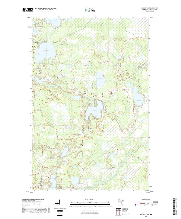
2022 Map of Hartley Lake
USGS Topo · Published 2022About this map
Hartley Lake lies at the center of this modern survey of Itasca County, where a intricate network of waterways and recreational corridors defines the landscape. The West Fork Prairie River meanders through the central terrain, connecting several prominent water bodies including Wolf Lake and Someman Lake. A significant portion of the area is dedicated to multi-use transit, anchored by the Taconite State Trl and the Little Moose Trl, which navigate the wetlands and wooded sections between Wasson Lake in the north and Lower Balsam Lake to the south. This area is characterized by low-lying hydrologic features like Balsam Creek and Day Brook, supporting a wilderness-heavy environment accessed by a web of county and local roads such as Scenic Hwy 7 and Hartley Lake Rd.
Find a feature on this map
57 named features on this map. Tap any name to fly to it.
Don’t see what you’re looking for? This feature index may not catch every label — zoom into the map to look around manually.
Map Details
Editions of this 2022 Hartley Lake Map
This is the sole edition of this map. No revisions or reprints were ever made.
Other maps of this area

1919 · Release
USGS Topo · 1:62,500

1920 · Trout Lake
USGS Topo · 1:62,500

1943 · Release
USGS Topo · 1:62,500

1952 · Nashwauk
USGS Topo · 1:24,000

1954 · Hibbing
USGS Topo · 1:250,000

1957 · Hibbing
USGS Topo · 1:250,000

1958 · Hibbing
USGS Topo · 1:250,000

1964 · Hibbing
USGS Topo · 1:250,000

1964 · Sherry Lake
USGS Topo · 1:24,000
1964 · O'Leary Lake
USGS Topo · 1:24,000