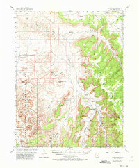
1954 Map of Harts Point
USGS Topo · Published 1973About this map
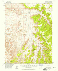
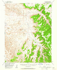
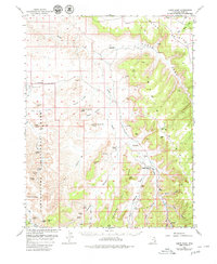
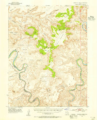
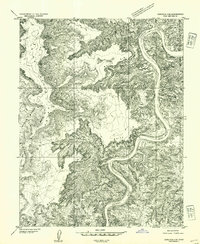
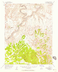
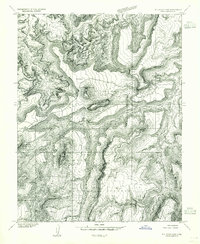
Dugout Ranch and Wilson Ranch anchor the remote pastoral and archaeological landscape of this San Juan County survey. Mapped in the mid-1950s with cooperation from the Atomic Energy Commission, the area shows a transition from cattle ranching to modern exploration, evidenced by several landing strips and numerous prospects. The western portion of the map is dominated by the nascent Canyonlands National Park, where the high desert is carved into complex drainages like Davis Canyon and Lavender Canyon. The presence of Indigenous history is remarkably dense here, with labeled sites including All American Man, Thirteen Faces, Tower Ruin, and various Petroglyphs. Notable landmarks such as North Six-shooter Peak and South Six-shooter Peak rise above the mesas, while the broad expanse of Bridger Jack Mesa defines the southern horizon.
Find a feature on this map
45 named features on this map. Tap any name to fly to it.
Don’t see what you’re looking for? This feature index may not catch every label — zoom into the map to look around manually.
Map Details
Editions of this 1954 Harts Point Map
4 editions found
Other maps of this area

1885 · La Sal
USGS Topo · 1:250,000

1886 · Abajo
USGS Topo · 1:250,000

1892 · Abajo
USGS Topo · 1:250,000

1893 · Abajo
USGS Topo · 1:250,000

1935 · Elk Ridge
USGS Topo · 1:96,000

1940 · Elk Ridge
USGS Topo · 1:125,000
1951 · Upheaval Dome
USGS Topo · 1:62,500
1952 · Carlisle 2 SE
USGS Topo · 1:24,000
1953 · The Needles
USGS Topo · 1:62,500
1954 · Elk Ridge 1 NW
USGS Topo · 1:24,000