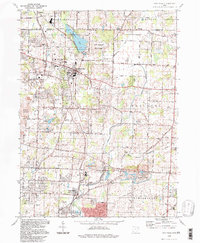
1994 Map of Hartville
USGS Topo · Published 1997About this map
The village of Hartville serves as the focal point of this northern Stark County landscape, situated at a transition between traditional agriculture and the expanding footprints of residential and recreational developments. To the north, the waters of Congress Lake and its surrounding golf club mark a long-standing local landmark, while the Quail Hollow State Park preserves a substantial tract of wooded terrain and open space. The infrastructure reflects a mix of eras, featuring the Wheeling and Lake Erie railroad line and a grid of rural routes like Swamp Street and Pontius Street.
Find a feature on this map
54 named features on this map. Tap any name to fly to it.
Don’t see what you’re looking for? This feature index may not catch every label — zoom into the map to look around manually.
Map Details
Editions of this 1994 Hartville Map
This is the sole edition of this map. No revisions or reprints were ever made.
Other maps of this area

1901 · Canton
USGS Topo · 1:62,500

1903 · Canton
USGS Topo · 1:62,500

1906 · Kent
USGS Topo · 1:62,500

1906 · Ravenna
USGS Topo · 1:62,500

1908 · Ravenna
USGS Topo · 1:62,500

1909 · Alliance
USGS Topo · 1:62,500

1950 · Cleveland
USGS Topo · 1:250,000

1951 · Canton
USGS Topo · 1:250,000

1953 · Canton
USGS Topo · 1:250,000

1956 · Cleveland
USGS Topo · 1:250,000