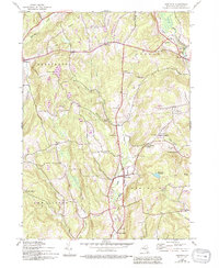
1943 Map of Hartwick
USGS Topo · Published 1994About this map
Hartwick serves as the central hub for this portion of Otsego County, situated at a junction near the Hartwick Reservoir. The landscape is defined by the steady flow of Otsego Creek and its West Branch, which carve through the high ground of Scotch Hill and Hemlock Hill. To the north, the small settlements of Oaksville and Cattown appear near the waters of Oaks Creek, while the village of Burlington sits at the western edge of the map along Butternut Creek.
Find a feature on this map
54 named features on this map. Tap any name to fly to it.
Don’t see what you’re looking for? This feature index may not catch every label — zoom into the map to look around manually.
Map Details
Editions of this 1943 Hartwick Map
4 editions found
Other maps of this area

1903 · Richfield Springs
USGS Topo · 1:62,500

1907 · Winfield
USGS Topo · 1:62,500

1907 · Cooperstown
USGS Topo · 1:62,500

1909 · Cooperstown
USGS Topo · 1:62,500

1910 · Hartwick
USGS Topo · 1:62,500

1912 · Hartwick
USGS Topo · 1:62,500

1943 · Schuyler Lake
USGS Topo · 1:24,000

1943 · Mt Vision
USGS Topo · 1:24,000

1943 · Milford
USGS Topo · 1:24,000

1943 · Richfield Springs
USGS Topo · 1:24,000