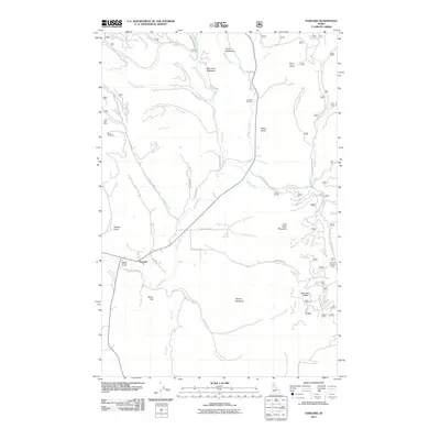
2011 Map of Harvard
USGS Topo · Published 2011About this map
Harvard sits along the Palouse River in a landscape defined by its mining heritage and timbered reaches. This survey documents the intersection of industrial history and the natural watershed, notably featuring the Gold Bug Mine and Gold Hill Mine in the western hills, alongside the Bonami Number 1 Mine to the east. The terrain is marked by distinctive family-named and topographic landmarks, from Moon Hill and Mount Margaret to the broad drainage of Quartz Creek. Local history is anchored at the Woodfell Cemetery north of the river, while recreation is represented by Camp Grizzly near the banks of the Palouse. The map's detailed road network, including Old River Rd and Last Chance Rd, traces the routes that once connected these high-country meadows and mining claims, offering a precise view of the region's early 21st-century footprint.
Find a feature on this map
55 named features on this map. Tap any name to fly to it.
Don’t see what you’re looking for? This feature index may not catch every label — zoom into the map to look around manually.
Map Details
Editions of this 2011 Harvard Map
This is the sole edition of this map. No revisions or reprints were ever made.
Other maps of this area

1955 · Pullman
USGS Topo · 1:250,000

1955 · Spokane
USGS Topo · 1:250,000

1957 · Emida
USGS Topo · 1:62,500

1957 · Tensed
USGS Topo · 1:62,500

1958 · Spokane
USGS Topo · 1:250,000

1958 · Pullman
USGS Topo · 1:250,000

1960 · Moscow Mtn
USGS Topo · 1:24,000

1960 · Potlatch
USGS Topo · 1:62,500

1961 · Deary
USGS Topo · 1:62,500

1981 · St Maries
USGS Topo · 1:100,000