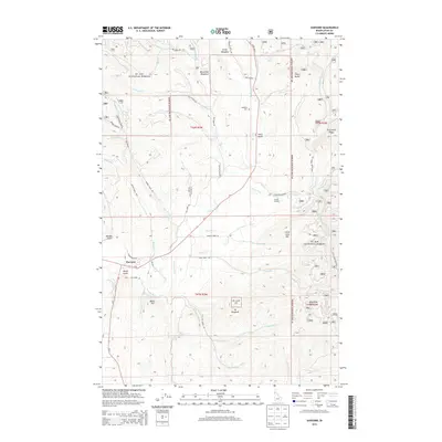
2013 Map of Harvard
USGS Topo · Published 2013About this map
Harvard sits along the Palouse River in the southwestern corner of this map, serving as a gateway to the wooded slopes of the St. Joe National Forest. The landscape is defined by the drainage network of the river and its many tributaries, including Quartz Cr and Ruby Cr. Local history is anchored by sites such as the Woodfell Cem and the meadows named for early settlers, like Smith Meadows and Macumber Meadows. High points such as Flynn Butte, Moon Hill, and Mt Margaret provide a vertical profile of the Latah County terrain. The presence of Camp Grizzly near Palouse River Rd suggests the area's continued role for recreation and outdoor activity within the national forest system, while roads like Stagecoach Rd and Old River Rd trace the path of historic transport routes through the valley.
Find a feature on this map
66 named features on this map. Tap any name to fly to it.
Don’t see what you’re looking for? This feature index may not catch every label — zoom into the map to look around manually.
Map Details
Editions of this 2013 Harvard Map
This is the sole edition of this map. No revisions or reprints were ever made.
Other maps of this area

1955 · Pullman
USGS Topo · 1:250,000

1955 · Spokane
USGS Topo · 1:250,000

1957 · Emida
USGS Topo · 1:62,500

1957 · Tensed
USGS Topo · 1:62,500

1958 · Spokane
USGS Topo · 1:250,000

1958 · Pullman
USGS Topo · 1:250,000

1960 · Moscow Mtn
USGS Topo · 1:24,000

1960 · Potlatch
USGS Topo · 1:62,500

1961 · Deary
USGS Topo · 1:62,500

1981 · St Maries
USGS Topo · 1:100,000