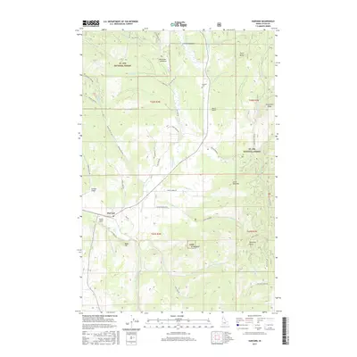
2017 Map of Harvard
USGS Topo · Published 2017About this map
The settlement of Harvard serves as the focal point for this 2017 survey of northern Latah County, where the Palouse River winds through a landscape of timbered ridges and creek-fed meadows. The northern portion of the quadrangle is dominated by the St Joe National Forest, characterized by landmarks such as Flynn Butte and Strychnine Ridge. This region is defined by a network of drainage systems, including Big Creek and Meadow Cr, which flow through high-altitude clearings like Smith Meadows and Macumber Meadows.
Find a feature on this map
59 named features on this map. Tap any name to fly to it.
Don’t see what you’re looking for? This feature index may not catch every label — zoom into the map to look around manually.
Map Details
Editions of this 2017 Harvard Map
This is the sole edition of this map. No revisions or reprints were ever made.
Other maps of this area

1955 · Pullman
USGS Topo · 1:250,000

1955 · Spokane
USGS Topo · 1:250,000

1957 · Emida
USGS Topo · 1:62,500

1957 · Tensed
USGS Topo · 1:62,500

1958 · Spokane
USGS Topo · 1:250,000

1958 · Pullman
USGS Topo · 1:250,000

1960 · Moscow Mtn
USGS Topo · 1:24,000

1960 · Potlatch
USGS Topo · 1:62,500

1961 · Deary
USGS Topo · 1:62,500

1981 · St Maries
USGS Topo · 1:100,000