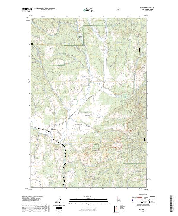
2024 Map of Harvard
USGS Topo · Published 2024About this map
The settlement of Harvard sits along the Palouse River at the intersection of Vale Rd and Flat Creek Rd, serving as a primary access point for the surrounding timberlands of the Saint Joe National Forest. This modern survey reveals a landscape defined by an intricate network of forestry and recreational paths, including the Palouse Ohv - Ruby Cr Trl and Little Sand Mt Trl.
Find a feature on this map
62 named features on this map. Tap any name to fly to it.
Don’t see what you’re looking for? This feature index may not catch every label — zoom into the map to look around manually.
Map Details
Editions of this 2024 Harvard Map
This is the sole edition of this map. No revisions or reprints were ever made.
Other maps of this area

1955 · Pullman
USGS Topo · 1:250,000

1955 · Spokane
USGS Topo · 1:250,000

1957 · Emida
USGS Topo · 1:62,500

1957 · Tensed
USGS Topo · 1:62,500

1958 · Spokane
USGS Topo · 1:250,000

1958 · Pullman
USGS Topo · 1:250,000

1960 · Moscow Mtn
USGS Topo · 1:24,000

1960 · Potlatch
USGS Topo · 1:62,500

1961 · Deary
USGS Topo · 1:62,500

1981 · St Maries
USGS Topo · 1:100,000