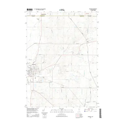
2015 Map of Harvard
USGS Topo · Published 2015About this map
Harvard serves as the primary hub of this northern Illinois region, where a dense grid of streets meets the open farmland of McHenry County. The landscape is defined by its proximity to the Wisconsin border, marked clearly by State Line Rd as it passes north of Big Foot Prairie. This 2015 survey illustrates a well-connected agricultural and residential corridor, characterized by a series of family and local burial grounds including Mount Auburn Cem, Saint Joseph Cem, and Jerome Cem. Small settlements like Alden dot the terrain to the east, while transportation and regional connectivity are highlighted by the presence of Kirkpatrick Airport near the state boundary. The map provides a contemporary record of how these rural communities and the town of Harvard are integrated into the rolling topography of the Upper Midwest.
Find a feature on this map
11 named features on this map. Tap any name to fly to it.
Don’t see what you’re looking for? This feature index may not catch every label — zoom into the map to look around manually.
Map Details
Editions of this 2015 Harvard Map
This is the sole edition of this map. No revisions or reprints were ever made.
Other maps of this area

1893 · Delavan
USGS Topo · 1:62,500

1893 · Geneva
USGS Topo · 1:62,500

1904 · Lake Geneva
USGS Topo · 1:62,500

1906 · Lake Geneva
USGS Topo · 1:62,500

1926 · Mc Henry
USGS Topo · 1:62,500

1932 · Harvard
USGS Topo · 1:48,000

1937 · Harvard
USGS Topo · 1:62,500

1944 · McHenry
USGS Topo · 1:62,500

1954 · Rockford
USGS Topo · 1:250,000

1955 · Rockford
USGS Topo · 1:250,000