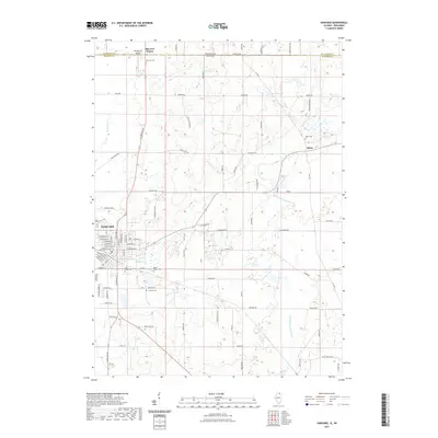
2021 Map of Harvard
USGS Topo · Published 2021About this map
Harvard sits at the southwestern corner of this survey, where the grid of city streets including W Diggins St and E Brink St gives way to the dairy lands of northern Illinois and southern Wisconsin. The landscape is defined by the N Br Kishwaukee River and several major tributaries like Lawrence Cr and Rush Cr that carve through the glacial till. Genealogical researchers will find several well-preserved rural burial grounds, including Big Foot Cem near the state line and Alden Cem to the east.
Find a feature on this map
50 named features on this map. Tap any name to fly to it.
Don’t see what you’re looking for? This feature index may not catch every label — zoom into the map to look around manually.
Map Details
Editions of this 2021 Harvard Map
This is the sole edition of this map. No revisions or reprints were ever made.
Other maps of this area

1893 · Delavan
USGS Topo · 1:62,500

1893 · Geneva
USGS Topo · 1:62,500

1904 · Lake Geneva
USGS Topo · 1:62,500

1906 · Lake Geneva
USGS Topo · 1:62,500

1926 · Mc Henry
USGS Topo · 1:62,500

1932 · Harvard
USGS Topo · 1:48,000

1937 · Harvard
USGS Topo · 1:62,500

1944 · McHenry
USGS Topo · 1:62,500

1954 · Rockford
USGS Topo · 1:250,000

1955 · Rockford
USGS Topo · 1:250,000