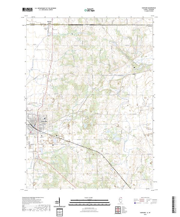
2024 Map of Harvard
USGS Topo · Published 2024About this map
Harvard serves as the primary urban center for this northern Illinois landscape, positioned just south of the Wisconsin-Illinois state line. The city's grid is well-defined by thoroughfares such as N Division St and W Brink St, with local history anchored at sites like Mount Auburn Cem and Saint Joseph Cem. Outside the city, the land transitions into a rolling agricultural expanse marked by the unincorporated community of Alden and the border settlement of Big Foot Prairie. This area is defined by the headwaters of the North Branch Kishwaukee River and Lawrence Creek, which carve gentle drainage patterns across the prairie. The map captures a contemporary snapshot of rural life in McHenry County, showing the enduring locations of family burial grounds like Jerome Cem alongside modern infrastructure such as the Kirkpatrick Airport.
Find a feature on this map
53 named features on this map. Tap any name to fly to it.
Don’t see what you’re looking for? This feature index may not catch every label — zoom into the map to look around manually.
Map Details
Editions of this 2024 Harvard Map
This is the sole edition of this map. No revisions or reprints were ever made.
Other maps of this area

1893 · Delavan
USGS Topo · 1:62,500

1893 · Geneva
USGS Topo · 1:62,500

1904 · Lake Geneva
USGS Topo · 1:62,500

1906 · Lake Geneva
USGS Topo · 1:62,500

1926 · Mc Henry
USGS Topo · 1:62,500

1932 · Harvard
USGS Topo · 1:48,000

1937 · Harvard
USGS Topo · 1:62,500

1944 · McHenry
USGS Topo · 1:62,500

1954 · Rockford
USGS Topo · 1:250,000

1955 · Rockford
USGS Topo · 1:250,000