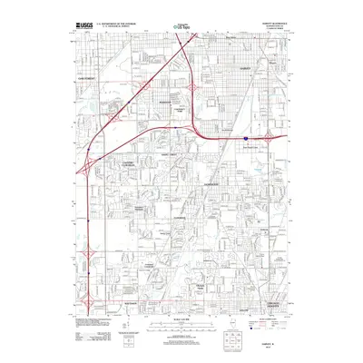
2012 Map of Harvey
USGS Topo · Published 2012About this map
Harvey and its surrounding suburban centers anchor this early 21st-century landscape, characterized by a dense grid of residential streets and heavy industrial infrastructure. The area is a critical node for transport and drainage, featuring the Calumet Union Drainage Canal and the Calumet Union Drainage Ditch. For genealogists and local historians, the sheet is particularly valuable for its documentation of numerous burial grounds, ranging from the large Saint Gabriel Catholic Cem to the smaller Elliott Family Cem and the Washington Memory Gardens. Institutional life is well represented through centers of learning like Prairie State College and Tolentine College. The natural hydrology of Midlothian Cr and Thorn Cr persists amidst the built environment of established neighborhoods such as Flossmoor, Homewood, and Chicago Heights.
Find a feature on this map
128 named features on this map. Tap any name to fly to it.
Don’t see what you’re looking for? This feature index may not catch every label — zoom into the map to look around manually.
Map Details
Editions of this 2012 Harvey Map
This is the sole edition of this map. No revisions or reprints were ever made.
Other maps of this area

1890 · Des Plaines
USGS Topo · 1:62,500

1892 · Calumet
USGS Topo · 1:62,500

1893 · Calumet
USGS Topo · 1:62,500

1894 · Des Plaines
USGS Topo · 1:62,500

1900 · Des Plaines
USGS Topo · 1:62,500

1900 · Calumet
USGS Topo · 1:62,500

1901 · Calumet
USGS Topo · 1:62,500

1901 · Des Plaines
USGS Topo · 1:62,500

1928 · Palos Park
USGS Topo · 1:24,000

1929 · Tinley Park
USGS Topo · 1:24,000