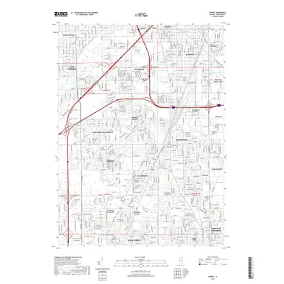
2018 Map of Harvey
USGS Topo · Published 2018About this map
Harvey and Chicago Heights anchor this dense suburban corridor south of Chicago as it appeared in the late 2010s. The landscape is defined by its complex hydrology and transportation networks, with the Calumet Union Drainage Canal and Calumet Union Drainage Ditch cutting across the northern sections near Posen and Phoenix. For those researching local roots, the map provides precise locations for several religious and civic burial grounds, including the Saint Gabriel Catholic Cem near Oak Forest and the County Cem in Markham. The residential patterns of established communities like Homewood, Flossmoor, and Hazel Crest are visible alongside smaller enclaves such as Holbrook and Crawford Countryside. Natural watercourses like Midlothian Cr and Butterfield Cr thread through the grids of street-level detail, illustrating the intersection of modern development and the original prairie drainage.
Find a feature on this map
131 named features on this map. Tap any name to fly to it.
Don’t see what you’re looking for? This feature index may not catch every label — zoom into the map to look around manually.
Map Details
Editions of this 2018 Harvey Map
This is the sole edition of this map. No revisions or reprints were ever made.
Other maps of this area

1890 · Des Plaines
USGS Topo · 1:62,500

1892 · Calumet
USGS Topo · 1:62,500

1893 · Calumet
USGS Topo · 1:62,500

1894 · Des Plaines
USGS Topo · 1:62,500

1900 · Des Plaines
USGS Topo · 1:62,500

1900 · Calumet
USGS Topo · 1:62,500

1901 · Calumet
USGS Topo · 1:62,500

1901 · Des Plaines
USGS Topo · 1:62,500

1928 · Palos Park
USGS Topo · 1:24,000

1929 · Tinley Park
USGS Topo · 1:24,000