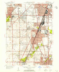
1953 Map of Harvey
USGS Topo · Published 1955About this map
Thornton, Bremen, and Rich townships define this post-war suburban landscape, where rapid residential growth meets a dense industrial and transit infrastructure. The massive Markham Yard dominates the central corridor, serving as a critical rail artery alongside the Illinois Central tracks. Institutional history is anchored by the Oak Forest Infirmary and the expansive St Mihiel Reserve, while the presence of the Old Indian Boundary line provides a geographic link to the region's earlier surveying history.
Find a feature on this map
78 named features on this map. Tap any name to fly to it.
Don’t see what you’re looking for? This feature index may not catch every label — zoom into the map to look around manually.
Map Details
Editions of this 1953 Harvey Map
This is the sole edition of this map. No revisions or reprints were ever made.
Other maps of this area

1890 · Des Plaines
USGS Topo · 1:62,500

1892 · Calumet
USGS Topo · 1:62,500

1893 · Calumet
USGS Topo · 1:62,500

1894 · Des Plaines
USGS Topo · 1:62,500

1900 · Des Plaines
USGS Topo · 1:62,500

1900 · Calumet
USGS Topo · 1:62,500

1901 · Calumet
USGS Topo · 1:62,500

1901 · Des Plaines
USGS Topo · 1:62,500

1928 · Palos Park
USGS Topo · 1:24,000

1929 · Tinley Park
USGS Topo · 1:24,000