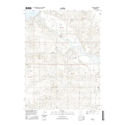
2015 Map of Harvey
USGS Topo · Published 2015About this map
Harvey and Durham sit at the center of this rural Marion County landscape, where the Des Moines River flows southeast toward Tracy. This mid-2010s survey reveals a high concentration of small family and community burial grounds, such as the Loynachan Farm Cem and Orey Cem, which are vital for genealogical research in Clay Township. The terrain is defined by the convergence of several waterways, including English Cr and Walnut Cr, which feed into the main river valley.
Find a feature on this map
67 named features on this map. Tap any name to fly to it.
Don’t see what you’re looking for? This feature index may not catch every label — zoom into the map to look around manually.
Map Details
Editions of this 2015 Harvey Map
This is the sole edition of this map. No revisions or reprints were ever made.
Other maps of this area

1909 · Knoxville
USGS Topo · 1:62,500

1910 · Pella
USGS Topo · 1:62,500

1912 · Knoxville
USGS Topo · 1:62,500

1912 · Pella
USGS Topo · 1:62,500

1924 · Melcher
USGS Topo · 1:62,500

1929 · Albia
USGS Topo · 1:62,500

1954 · Des Moines
USGS Topo · 1:250,000

1956 · Des Moines
USGS Topo · 1:250,000

1957 · Des Moines
USGS Topo · 1:250,000
1965 · Otley
USGS Topo · 1:24,000