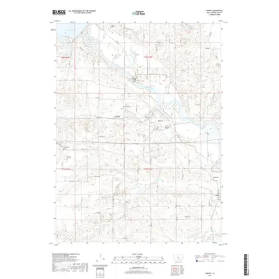
2018 Map of Harvey
USGS Topo · Published 2018About this map
Lake Red Rock and the Des Moines River dominate the northern landscape of this Marion County corridor, where the water's path has long shaped local infrastructure and settlement. The small communities of Harvey and Durham sit south of the river, connected to the northern banks by significant crossings like the Wabash Railroad Bridge and the Harvey Railroad Bridge. The river's influence is seen in the numerous tributaries carving through the terrain, including English Cr, Walnut Cr, and Willow Cr. For genealogists and local historians, the area is notably dense with family and pioneer burial grounds. Numerous small cemeteries are scattered throughout the countryside, such as Loynachan Farm Cem, Porter Grove Cem, and Breckenridge Cem, often situated near early transit routes like Old State Hwy 92.
Find a feature on this map
67 named features on this map. Tap any name to fly to it.
Don’t see what you’re looking for? This feature index may not catch every label — zoom into the map to look around manually.
Map Details
Editions of this 2018 Harvey Map
This is the sole edition of this map. No revisions or reprints were ever made.
Other maps of this area

1909 · Knoxville
USGS Topo · 1:62,500

1910 · Pella
USGS Topo · 1:62,500

1912 · Knoxville
USGS Topo · 1:62,500

1912 · Pella
USGS Topo · 1:62,500

1924 · Melcher
USGS Topo · 1:62,500

1929 · Albia
USGS Topo · 1:62,500

1954 · Des Moines
USGS Topo · 1:250,000

1956 · Des Moines
USGS Topo · 1:250,000

1957 · Des Moines
USGS Topo · 1:250,000
1965 · Otley
USGS Topo · 1:24,000