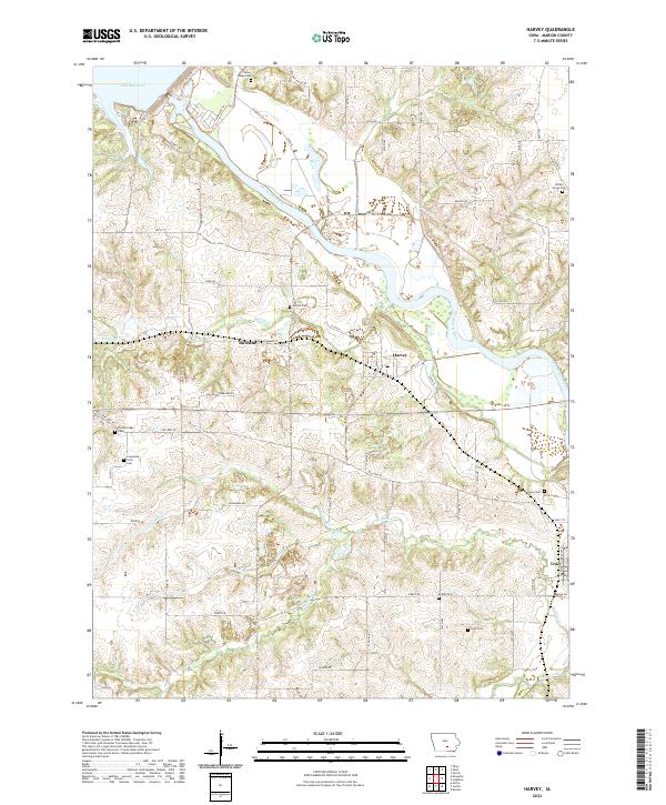
2022 Map of Harvey
USGS Topo · Published 2022About this map
The Des Moines River winds through this central Iowa landscape, shaping the development of riverbank communities like Harvey and Tracy. The terrain is defined by the significant hydrological influence of Lake Red Rock in the northwest, which gives way to a network of smaller tributaries including English Cr and Walnut Cr. This modern survey reveals a persistent rural settlement pattern punctuated by numerous family and community burial grounds, such as Loynachan Farm Cem and Timber Ridge Cem, which serve as vital markers of the region's agricultural heritage.
Find a feature on this map
65 named features on this map. Tap any name to fly to it.
Don’t see what you’re looking for? This feature index may not catch every label — zoom into the map to look around manually.
Map Details
Editions of this 2022 Harvey Map
This is the sole edition of this map. No revisions or reprints were ever made.
Other maps of this area

1909 · Knoxville
USGS Topo · 1:62,500

1910 · Pella
USGS Topo · 1:62,500

1912 · Knoxville
USGS Topo · 1:62,500

1912 · Pella
USGS Topo · 1:62,500

1924 · Melcher
USGS Topo · 1:62,500

1929 · Albia
USGS Topo · 1:62,500

1954 · Des Moines
USGS Topo · 1:250,000

1956 · Des Moines
USGS Topo · 1:250,000

1957 · Des Moines
USGS Topo · 1:250,000
1965 · Otley
USGS Topo · 1:24,000