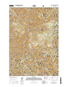
2017 Map of Harvey Mountain
USGS Topo · Published 2017About this map
The Willamette National Forest dominates this section of the Cascade Range in Lane County, Oregon. This 2017 survey details a landscape defined by sharp peaks and a dense network of mountain streams. High points such as Deathball Mtn, Harvey Mountain, and Katsuk Butte rise above the drainage basins of Quartz Cr and Ennis Cr. The mapping of numerous National Forest Development Roads, including Natl Forest Develop Road 2618 Rd and Natl Forest Develop Road 1837 Rd, illustrates the complex infrastructure managed by the forest service for timber access and fire management. To the south, Hehe Mtn and the distinct formation of Symbol Rock stand near the headwaters of Doe Cr and Buck Cr, while Indian Ridge marks the southeastern boundary of this high-elevation terrain.
Find a feature on this map
53 named features on this map. Tap any name to fly to it.
Don’t see what you’re looking for? This feature index may not catch every label — zoom into the map to look around manually.
Map Details
Editions of this 2017 Harvey Mountain Map
This is the sole edition of this map. No revisions or reprints were ever made.
Other maps of this area

1925 · Waldo Lake
USGS Topo · 1:125,000

1934 · Mc Kenzie Bridge
USGS Topo · 1:96,000

1940 · Mc Kenzie Bridge
USGS Topo · 1:125,000

1953 · Salem
USGS Topo · 1:250,000

1954 · Salem
USGS Topo · 1:250,000

1955 · Chucksney Mtn
USGS Topo · 1:62,500

1955 · Blue River
USGS Topo · 1:62,500

1955 · Mc Kenzie Bridge
USGS Topo · 1:62,500

1956 · Sardine Butte
USGS Topo · 1:62,500

1958 · Roseburg
USGS Topo · 1:250,000