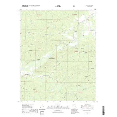
2020 Map of Harvey
USGS Topo · Published 2020About this map
The Fourche LaFave River meanders through this portion of the Ouachita National Forest, where the topography is defined by high ridges and deep hollows. The settlement of Harvey sits near the river, surrounded by a landscape marked by family names and early rural infrastructure. To the west, Cedar Creek provides a secondary focal point for the region's historical geography.
Find a feature on this map
71 named features on this map. Tap any name to fly to it.
Don’t see what you’re looking for? This feature index may not catch every label — zoom into the map to look around manually.
Map Details
Editions of this 2020 Harvey Map
This is the sole edition of this map. No revisions or reprints were ever made.
Other maps of this area

1887 · Mount Ida #2
USGS Topo · 1:62,500

1890 · Mount Ida
USGS Topo · 1:125,000

1955 · Little Rock
USGS Topo · 1:250,000

1956 · Little Rock
USGS Topo · 1:250,000

1959 · Oden
USGS Topo · 1:62,500

1959 · Mount Ida
USGS Topo · 1:62,500

1960 · Little Rock
USGS Topo · 1:250,000

1960 · Gravelly
USGS Topo · 1:62,500
1960 · Parks
USGS Topo · 1:62,500

1964 · Little Rock
USGS Topo · 1:250,000