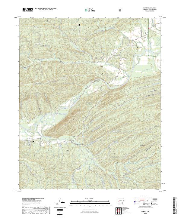
2024 Map of Harvey
USGS Topo · Published 2024About this map
The Fourche LaFave River meanders through this portion of the Ouachita National Forest, where the settlement of Harvey sits at the confluence of several local road networks. This 2024 landscape is defined by its ridge-and-hollow topography, with named features like John Sanders Ridge, Bogus Ridge, and Hickory Ridge alternating with drainage basins such as Owens Hollow and White Oak Hollow. For genealogists, the map identifies several local burial sites including Harvey Cem, Sanders Cem, and Big Cedar Cem near the winding course of Big Cedar Creek. The presence of labels like Stillhouse Hollow and Papa Bend suggests a history of local activity and land use that predates modern forestry management. Transportation is represented by a mix of forest routes and county roads, including Brushy Creek Rd and the aptly named Indian Trail Rd.
Find a feature on this map
75 named features on this map. Tap any name to fly to it.
Don’t see what you’re looking for? This feature index may not catch every label — zoom into the map to look around manually.
Map Details
Editions of this 2024 Harvey Map
This is the sole edition of this map. No revisions or reprints were ever made.
Other maps of this area

1887 · Mount Ida #2
USGS Topo · 1:62,500

1890 · Mount Ida
USGS Topo · 1:125,000

1955 · Little Rock
USGS Topo · 1:250,000

1956 · Little Rock
USGS Topo · 1:250,000

1959 · Oden
USGS Topo · 1:62,500

1959 · Mount Ida
USGS Topo · 1:62,500

1960 · Little Rock
USGS Topo · 1:250,000

1960 · Gravelly
USGS Topo · 1:62,500
1960 · Parks
USGS Topo · 1:62,500

1964 · Little Rock
USGS Topo · 1:250,000