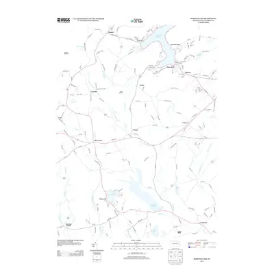
2013 Map of Harveys Lake
USGS Topo · Published 2013About this map
Harveys Lake dominates the northern landscape of this region, surrounded by a dense network of shoreline communities including Laketon, Wordan Place, and Shawanese. The rugged terrain of Kocher Mountain and Bear Hollow provides a natural contrast to the settled valleys where Pikes Creek flows southward toward the Pikes Creek Reservoir. This hydrological system is central to the area's geography, with numerous smaller water bodies such as Lake Silkworth and Scarlet Lake dotting the landscape. The settlement pattern follows the local topography, with established hamlets like Idetown, Lehman, and Cease Mills linked by roads that wind through the hollows. The presence of naming conventions like Outlet and Ceasetown reflects a long history of water management and local industry tied to the region's abundant creeks and runs.
Find a feature on this map
154 named features on this map. Tap any name to fly to it.
Don’t see what you’re looking for? This feature index may not catch every label — zoom into the map to look around manually.
Map Details
Editions of this 2013 Harveys Lake Map
This is the sole edition of this map. No revisions or reprints were ever made.
Other maps of this area

1891 · Wilkesbarre
USGS Topo · 1:62,500

1891 · Harveys Lake
USGS Topo · 1:62,500

1893 · Harvey Lake
USGS Topo · 1:62,500

1893 · Pittston
USGS Topo · 1:62,500

1894 · Shickshinny
USGS Topo · 1:62,500

1894 · Wilkesbarre
USGS Topo · 1:62,500

1943 · Scranton
USGS Topo · 1:125,000

1946 · Nanticoke
USGS Topo · 1:31,680

1946 · Shickshinny
USGS Topo · 1:31,680

1946 · Kingston
USGS Topo · 1:24,000
Featured Places
- Dallas Township, PA
- Lehman Township, PA
- Harveys Lake, PA
- Hunlock Township, PA
- Roaring Brook, Hunlock Township