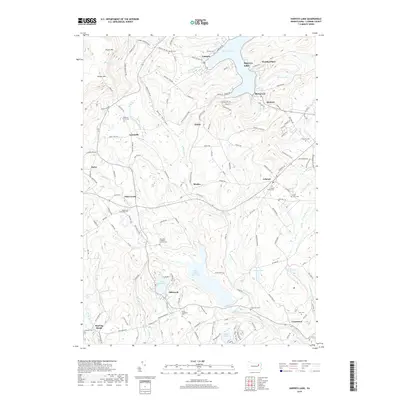
2019 Map of Harveys Lake
USGS Topo · Published 2019About this map
Harveys Lake dominates the northeastern corner of this Luzerne County landscape, serving as a focal point for surrounding communities like Laketon, Wordan Place, and Shawanese. The area's complex hydrography is defined by the Harveys Creek drainage system, which feeds into the substantial Pikes Creek Reservoir and the smaller Lake Silkworth. The terrain rises sharply to the northwest toward North Mountain and Kocher Mountain, creating a distinct separation between the lakeland settlements and the higher elevations near Bear Hollow.
Find a feature on this map
141 named features on this map. Tap any name to fly to it.
Don’t see what you’re looking for? This feature index may not catch every label — zoom into the map to look around manually.
Map Details
Editions of this 2019 Harveys Lake Map
This is the sole edition of this map. No revisions or reprints were ever made.
Other maps of this area

1891 · Wilkesbarre
USGS Topo · 1:62,500

1891 · Harveys Lake
USGS Topo · 1:62,500

1893 · Harvey Lake
USGS Topo · 1:62,500

1893 · Pittston
USGS Topo · 1:62,500

1894 · Shickshinny
USGS Topo · 1:62,500

1894 · Wilkesbarre
USGS Topo · 1:62,500

1943 · Scranton
USGS Topo · 1:125,000

1946 · Nanticoke
USGS Topo · 1:31,680

1946 · Shickshinny
USGS Topo · 1:31,680

1946 · Kingston
USGS Topo · 1:24,000
Featured Places
- Dallas Township, PA
- Lehman Township, PA
- Harveys Lake, PA
- Hunlock Township, PA
- Roaring Brook, Hunlock Township