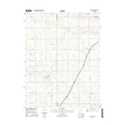
2015 Map of Harveyville
USGS Topo · Published 2015About this map
Harveyville sits at the heart of this landscape where Wabaunsee, Shawnee, and Osage counties converge. The terrain is defined by a dense network of drainage systems, including the S Br Wakarusa River to the north and Dragoon Creek and Soldier Cr to the south. This 2015 survey illustrates a rural Kansas environment still anchored by its section-line road grid and small-scale water features like Smith Lake.
Find a feature on this map
50 named features on this map. Tap any name to fly to it.
Don’t see what you’re looking for? This feature index may not catch every label — zoom into the map to look around manually.
Map Details
Editions of this 2015 Harveyville Map
This is the sole edition of this map. No revisions or reprints were ever made.
Other maps of this area

1885 · Eskridge
USGS Topo · 1:125,000

1889 · Burlingame
USGS Topo · 1:125,000

1889 · Eskridge
USGS Topo · 1:125,000

1894 · Eskridge
USGS Topo · 1:125,000

1894 · Burlingame
USGS Topo · 1:125,000

1947 · Lawrence
USGS Topo · 1:250,000

1950 · Lawrence
USGS Topo · 1:250,000

1952 · Auburn
USGS Topo · 1:24,000

1952 · Harveyville
USGS Topo · 1:24,000
1952 · Dover
USGS Topo · 1:24,000