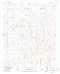
1981 Map of Hasperos Camp
USGS Topo · Published 1981About this map
Hasperos Camp and the small settlement of Hasperos anchor this high-desert landscape in Lincoln County, New Mexico. Surveyed in the 1970s and published in the early 1980s, the map reveals a remote ranching terrain defined by water management and natural drainage systems. The dry landscape is punctuated by vital infrastructure for livestock and settlement, including Trujillo Well, Johnson Well, and scattered water storage points like North Hasperos Tank and Parker Tank.
Find a feature on this map
17 named features on this map. Tap any name to fly to it.
Don’t see what you’re looking for? This feature index may not catch every label — zoom into the map to look around manually.
Map Details
Editions of this 1981 Hasperos Camp Map
This is the sole edition of this map. No revisions or reprints were ever made.
Other maps of this area

1954 · Fort Sumner
USGS Topo · 1:250,000

1955 · Roswell
USGS Topo · 1:250,000

1958 · Fort Sumner
USGS Topo · 1:250,000

1958 · Roswell
USGS Topo · 1:250,000

1962 · Roswell
USGS Topo · 1:250,000

1973 · Chupadero Mountain
USGS Topo · 1:24,000

1973 · Jicarilla Peak
USGS Topo · 1:24,000

1980 · Corona
USGS Topo · 1:100,000
1981 · Pedernal Arroyo
USGS Topo · 1:24,000
1981 · Pelon Hill
USGS Topo · 1:24,000